- Home Page /
- Books /
- Engineering & Transportation /
- Engineering /
- Computer Modelling /
- Remote Sensing & GIS /
- Introduction to Spatial Data Analysis





Item #:
145383070
Introduction to Spatial Data Analysis
90% of respondents would recommend this to a friend
Item #:
145383070
BZD 140
Price Details
Excluding Shipping & Custom charges ( Shipping and custom charges will be calculated on checkout )
*All items will import from US
0 ratings
Write a review
In stock
 Imported from USA store
QTY:
Only 2 items left in stock.
Order now and get it around Monday, October 19
Secured transaction
Ubuy works hard to protect your security and privacy. Our advanced payment security system ensures confidentiality by encrypting your information during transmission using AES (Advanced Encryption Standards) and SSL (Secure Socket Layer) protocols. Your payment details are 100% secure as we do not share your payment details with third party sellers.
Our Top Logistics Partners


This book empowers readers to turn field data into actionable spatial insights using QGIS and R.

Fast
Shipping

Free
Return*

Secure Packaging

100% Original Products

PCI DSS Compliance

ISO 27001 Certified



What Stands Out
Comprehensive Overview
Covers foundational concepts and advanced techniques in spatial data analysis, making it suitable for beginners and seasoned analysts alike.
Hands-On Learning
Includes practical exercises and real-world case studies, allowing users to apply concepts and solidify their understanding effectively.
Interdisciplinary Approach
Integrates knowledge from geography, statistics, and computer science, ensuring a well-rounded perspective on spatial issues and their solutions.
Product Details
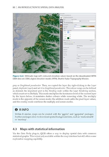
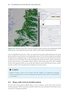
- This is a book about how environmental scientist can integrate remote sensing and GIS in their research. It will allow readers to get started with the application of remote sensing as well as GIS and to understand its potential and limitations. Using practical examples, the book covers all necessary steps from planning field campaigns to deriving relevant environmental information through remote sensing and modelling of species distributions.This book introduces spatial data handling using the open source software Quantum GIS (QGIS). In addition, readers will be guided through their first steps in the R programming language. The authors explain the fundamentals of spatial data handling and analysis, empowering the reader to turn data acquired in the field into actual spatial data. Readers will learn to process and analyse spatial data of different types and interpret the data and results. After finishing this book, readers will be able to address questions such as What is the distance to the border of the protected area?, Which points are located close to a road?, Which fraction of land cover types exist in my study area? using different software and techniques. This book is for novice spatial data users and does not assume any prior knowledge of spatial data itself or practical experience working with such data sets. Readers will likely include student and professional ecologists, geographers and any environmental scientists or practitioners who need to collect, visualize and analyse spatial data. The software used will be the widely applied open source scientific programs QGIS and R. All scripts and data sets used in the book will be provided online at book.ecosens.org. This book covers specific methods including:* what to consider before collecting in situ data* how to work with spatial data collected in situ* the difference between raster and vector data* how to acquire further vector and raster data* how to create relevant environmental information* how to combine and analyse in situ and remote sensing data* how to create useful maps for field work and presentations* how to use QGIS and R for spatial analysis* how to develop analysis scripts
| Publisher | Pelagic |
| Publication date | November 7, 2020 |
| Language | English |
| Print length | 300 pages |
| ISBN-10 | 1784272132 |
| ISBN-13 | 978-1784272135 |
| Item Weight | 1.1 pounds (500 grams) |
| Dimensions | 6.76 x 0.43 x 9.68 inches (17.2 x 1.1 x 24.6 cm) |
| Part of series | Data in the Wild |
Who Should Buy?

-
Students in Geography
Ideal for geography students seeking foundational knowledge in spatial data methods and analysis techniques.
-
Urban Planners
Urban planners can enhance their skills in analyzing spatial data to inform their city planning and zoning decisions.
-
Environmental Researchers
Environmental researchers benefit by learning spatial analysis for better understanding of ecological patterns and resource management.

-
Casual Hobbyists
Not suitable for casual hobbyists who prefer simple geographic tools without in-depth analytical techniques.
Product Description
Have any Query? Chat with us
Customer Questions & Answers
-
Question:
How to Shop Introduction to Spatial Data Analysis Online From Ubuy?
Answer: It’s easy to shop Introduction to Spatial Data Analysis online from Ubuy. You just have to search for the product, choose your shipping method while checking out and get it delivered to your location. -
Question:
Is Introduction to Spatial Data Analysis Available to Shop Online in Belize?
Answer: Yes, at Ubuy Belize this product is available for you to shop at a reasonable price. The Introduction to Spatial Data Analysis is not available locally but you can trust us with our express shipping services. -
Question:
How Long Does It Take to Get Product After Placing the Order?
Answer: The delivery time of your ordered product varies as per what you've ordered and the shipping method that you've chosen. The estimated delivery time is mentioned during the checkout process, so be carefree while shopping.
Remote Sensing & GIS Editorial Review
Introduction to Spatial Data Analysis is a comprehensive guide published by Pelagic on November 7, 2020, that spans 300 pages and delves deep into the intricacies of spatial data. This resourceful book is written in English and is ideal for both newcomers and seasoned professionals in the field. It covers various analytical methods and their applications, providing readers with a robust understanding of spatial data's role in research and decision-making. The book's dimensions make it manageable for fieldwork while still offering extensive content to enhance knowledge in spatial analysis.
Customer Reviews & Ratings
11 customers ratings
-
5 Star
76%
-
4 Star
0%
-
3 Star
12%
-
2 Star
12%
-
1 Star
0%
Review this product
Share your thoughts with other customers
Pros
- Engaging content covering analytical methods
- Ideal for both beginners and professionals
- Thorough exploration of spatial data applications
- Well-organized with clear explanations
- Portable size for fieldwork
Cons
- Some concepts may require additional background knowledge
Customers also viewed these products
Product Price History
Important information
- Limitations : For products shipped internationally, please note that any manufacturer warranty may not be valid; manufacturer service options may not be available; product manuals, instructions, and safety warnings may not be in destination country languages; the products (and accompanying materials) may not be designed in accordance with destination country standards, specifications, and labeling requirements; and the products may not conform to destination country voltage and other electrical standards (requiring use of an adapter or converter if appropriate). The recipient is responsible for assuring that the product can be lawfully imported to the destination country. When ordering from Ubuy or its affiliates, the recipient is the importer of record and must comply with all laws and regulations of the destination country.
- Not all the products listed on Ubuy are for sale, as Ubuy is a global search engine. Products are subject to export/trade regulations.
BZD 140
Order now and get it around Monday, October 19
This item is not restrict in my country.(Please click on above link if this item is not restrict in your country, So our team will review and allow.)
QTY:
Only 2 items left in stock.
Secured transaction
PCI DSS compliant and ISO 27001:2022 certified, with encrypted payments and full buyer protection on every order.
Our Top Logistics Partners
Fastest cross-border delivery
Features & Benefits
- Integrates remote sensing and GIS for environmental research.
- Practical examples guide the application of spatial data analysis.
- Includes foundational training in QGIS and R programming.
- Covers methods for dealing with in situ data and its analysis.
- Equips readers to answer critical environmental questions.
- Designed for novices without prior spatial data experience.
Ubuy Assurance
Experience worry-free shopping with 100% original products, PCI DSS-compliant payment security, ISO 27001-certified data protection, the fastest cross-border delivery, free returns *, and secure packaging on every order.